
Road to Xinjiang
Overland on the Karakoram Highway

In 1992 I travelled the Silk Road overland from Northern Pakistan to Xinjiang.
To prepare I read Peter Hopkirk's book 'The Great Game' to get a historical perspective on the Central Asian regions.
What I wasn't prepared for was the sometimes inhospitable landscape that was at the same time breathtaking.
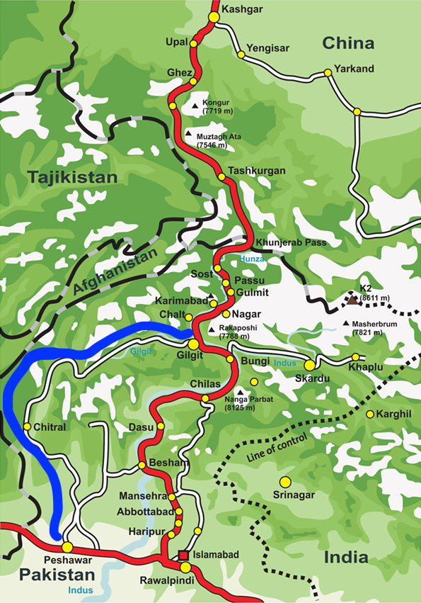
The red line on the map is the main road called the Karakoram Highway. Wanting to explore the Pakistani-Afghani border, we decided to travel an additional loop which is marked in blue.
Hiring a jeep with a group of other travellers, the 6 of us set off from Peshawar in a rickety vehicle towards our first stop in Chitral. There were endless switch back roads the wound up a mountain and then down the other side. Endless landslips due to rain. This is a terrain that is not suited to driving.
The next section was even more challenging.
Chitral to Gilgit took us about 3 days, only to arrive in Gilgit which was under lockdown for a few days. Four years prior was the Gilgit Massacre that refers to the state-sponsored mass killing of Shia civilians. Much of this North-West Frontier Province area has had tense conflict over the centuries and these high-altitude areas are difficult to govern. Much less find where a country border might be.
On the journey to Gilgit, there were two stops along the road - Mastuj and Gupis. And when I say on the road, we slept under that stars those two nights. Luckily there was an extra pup tent to sleep in as nights even in the summer are cold.
Food was scarce and the driver of the jeep and his companion made dal and rice over a small portable kerosene stove. As is Muslim tradition, food is shared with the saying ‘an individual should not eat until they feed someone who is hungry’. All along the road we were met with hospitality.
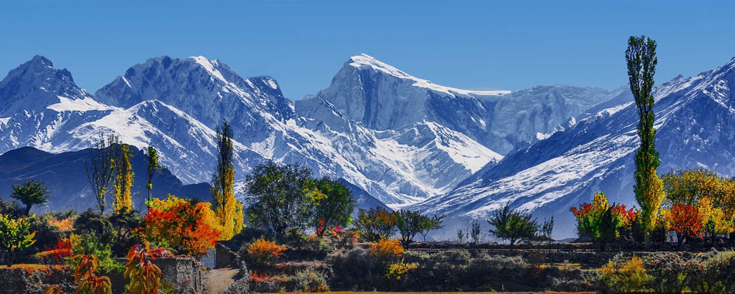
Once through Gilgit, we were back on the main paved Karakoram Highway and stayed in Karimabad, formerly known as Baltit, is the capital of Hunza District. Photo above of Hunza Valley. This area is famously known as being Shangri-la which described in the 1933 novel Lost Horizon by English author James Hilton.
Hilton portrays Shangri-La as a mystical, harmonious valley, gently guided from a lamasery, enclosed in the western end of the Kunlun Mountains.
Shangri-La has become synonymous with any earthly paradise, particularly a mythical Himalayan utopia – an enduringly happy land, isolated from the world.
In the novel, the people who live in Shangri-La are almost immortal, living hundreds of years beyond the normal lifespan and only very slowly aging in appearance.
We then headed to the border at Sost and the next section of our journey warrants a whole other post.
Let me just say this, in 1992 the bus rides were long, vehicles were old and broke down often, roads were not fully paved, the landscape was vast, food was scarce, places to stay were few.
Jumping to 30 years later, some things still hold true.
distances are huge
mountain passes are extremely high
building road and train systems is challenging
Xinjiang sits at the center of the land portion for Eurasian commerce that can replace sea trade routes that are controlled by other countries
But what is different is that China is actively building roadways, railways, and even pipelines. The project is known as the Pakistan-China Economic Corridor.
'If you want to be wealthy, build roads first' as the famous Chinese saying goes. China is building and connecting countries overland across Central Asia.
That is where trade starts.
One Belt One Road ( 一带一路) is the New Silk Road.
View the short documentary below, this is filmed 30 years after I travelled the Karakoram Highway. This is World's Highest Highway known as the Pakistan-China Economic Corridor.
This is 12 minutes of what is felt like journeying through this terrain.